Day 1.
11 August 2012.
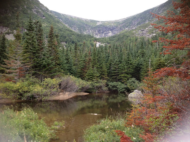
253 km. Travel time 13 hours 19 minutes. Average speed 19 km/h. Total ascent 1986 m. Border crossing. New-York state.
11 August 2012.
253 km. Travel time 13 hours 19 minutes. Average speed 19 km/h. Total ascent 1986 m. Border crossing. New-York state.

It was my second long trip this year.
This time I started my final preparations several days before my
leaving date. Now I was going to spend 10 days on the road and I was afraid to forget something. Do I have
enough food, liquids and all the tools? Do I need 1, 2 or 3 spare tubes?
What rain/warm gear to take? Finally, it was around 10 in the morning that
the bike was loaded with everything and I hit the road.
So what do you take on a 10 day trip? Again, on the handlebar I have 20 litres dry bag with the tent,
inflatable mattress, down blanket and all my clothes, everything of the most light
variety but the bag grew heavy quickly when everything was pressed
inside. The bag fitted nicely between my flat handlebar and a
single-piece curved aerobar, which also served as a mounting point
for the light. Then there were three other bags all ordered from
Revelate Designs: a frame bag with 2-litres carton of orange juice,
above it a small gas tank, actually, big enough to hold a half kilo
of nuts, tools, front light and a handful of other small items; and a
big Viscacha bag under the saddle with all my food - 20 or 25
packages of freeze-dried food (That proved to be too much, I came
back with half of it uneaten: lasagna was absolutely awful, and I was only able to go
through 2 portions, chili-macaroni with beef, on the other hand,
turned out again to be a good choice, but, for some reason, I only
took just several packages of it). Everything else went into backpack:
hiking shoes, stove, windscreen for stove, gas container, mug, 4L
Dromedary bag with water, bike lock, soap, toothpaste, electrical tape, extra batteries,
backup Garmin Oregon GSP, helmet light, kettle, a box with 40 tea bags, matches, etc., and also a bag with
some normal food – 15 pancakes with cottage cheese and a piece of
pie. Out of all these things only
freeze-dried lasagna proved useless and actually damaging to my
stomach. But I had to eat several portions of it to finally
understand this. And the most important piece was a navigation unit - iPhone in a waterproof case with maps and cycling computer. iPhone was permanently connected to the hub dynamo.
The plan was to ride to the Dolly Copp
campground at the foot of Mount Washington in New Hampshire, spent a
night there and on the next day hike up the highest mountain of
Northeast America, climb down, spent another night in the campground
and then continue on to Portland, Maine. After that, turn south and
ride along Atlantic coast to Boston and then go back
and return to Ottawa leaving Adirondack Park to the north and thus
avoiding its killing hills. I had 10 days. Later I decided to spent 1
day to do a foot-tour of Portland and skip Boston again this time (on
my first trip in May I had to stop 100 km short of Boston because I
ran out of time and had a sudden fit of the shits caused by chicken teriyaki) but spent some time on Atlantic beaches.
 |
| Bike is ready to go. The photo was taken early in May on my first test ride. |
There was no particular reason or goal
for this trip, I didn't want to test myself, I already did this in
May on a 5-days trip and survived. And, besides, I was in a better
condition now then in May – two weeks ago I completed Ottawa
GranFondo 220 km in 6 hours 40 minutes at an average speed 33.3 km/h riding mostly alone
– my best longest ride. Nor was I
interested in visiting any particular place - I could go anywhere. But I
had 10 days of vacation and simply wanted to move, to do some aimless
floating in space and time, to get lost. Bicycle was an obvious
choice, I would never do this in a car, because driving a car is not an
act of moving, but that of prolonged sitting and a sure way to get
bad headaches. Well, cycling is more about sitting too, but at least
it creates an illusion of moving because your heart is racing. The
only true moving is walking or running, and I would like to do all my
travels on foot, but I don't have time and I am not sure that I can
carry all my gear and provisions on my back. So cycling is a good
compromise.
The only planning required was to
select some route and fill it with more or less interesting
excursions. Riding a bicycle is a rather pleasant activity for the
first 3-4, sometimes 5-6 hours, depending on the surroundings, but
because most travelling I do in my area is on the same-looking roads,
it becomes boring very soon, and on top of that you start feel
fatigue from heat (or rain) and some inconvenience in certain places.
Though the latter is much alleviated by my latest body geometry
saddle with a clever cut-out. Still, it only works up to a point,
this is the biggest inconvenience in bike travel, no matter what
saddle you have. On my 10th day I discovered a way how to
avoid this – shift to the biggest gear and ride standing on the
pedals, resting every several turns on straightened leg, alternating
left and right leg, while the bike maintains momentum. This technique
allows to keep speed at a reasonable 25 km/h. This is how I rode my
last 40 km home.
I decided to cross US border at
Cornwall – the same place I did back in May, it's about 140 km from
Ottawa. It was sunny for most of the ride, but the storm that was in
the forecast finally materialized when I was near the bridge across the border. I just
put on my waterproof shorts and continued under a light rain with
occasional bursts of downpour. While I was riding along St Lawrence
river I noticed a small group of cyclists on road bikes huddled under
the trees. They didn't appear too happy, but I was riding and didn't
feel rain at all.
In fact, I enjoyed it, because for me
it was rather an advantage, although a cold one to embrace. The
biggest risk during summer rides is dehydration, even if it rains it
still not too cold to cause you to suffer much. I thought about my
first day of riding during my first 5-days trip back in May, almost
the same route, but very hot day. Then I crossed the border and was
heading into Adirondack Park, I felt good until I reached 160 km
mark. And then I felt something was wrong, the first waves of nausea
briefly touched me, I was going slower and slower, my heart slowed and refused to respond to all the efforts, legs became so weak that even the
smallest incline was unbearably hard. I stopped and had to crawl into
the nearest field. There I lay on my back for 20-30 minutes trying to
recover and get some water inside. But I already went beyond some
point that even drinking was difficult. It was like my digestive
system was shutting down, you cannot eat or drink anything until you
have rested enough, probably the same feeling that high-altitude
alpinists have when they climb into death zone. I was able to continue after that for
another 30 km, but as soon as the road went up I bailed. I pitched
the tent in the wood beside the road, boiled some water and prepared
my evening meal. It was rice and tea. I tried hard to force
everything down and couldn't. The rice tasted like it was a dry sand and I could not drink anything.
That day I thought that my trip was over, only 192 km or riding and I
was completely wasted. There is no way I could make it to Boston. I
spent sleepless night listening to the distant howling. Dogs, wolfs
or coyotes? I don't know, but by the morning it became so loud and really began getting on my nerves. I got up, finished my cold rice and drank
hot tea with two snickers bars. Surprisingly I felt better and by 7
o'clock I was climbing into the hills ahead.
But now I was wet and warm and was
thankful for that. Eventually, when I reached the bridge and stopped
at the lights on the intersection the storm arrived. Violent but
short-lived, as usual. I looked around for shelter and ran into the lee of one of the bridge piers. In fifteen minutes the storm abated enough so that I could
continue across the bridge. Soon I was on the other side, on the wide
and smooth American roads. The majority of roads are designated as
bike routes and have a very wide shoulder, something that you never
see in Canada.
After 10 km I stopped and dined on my
pancakes and orange juice. The weather improved. It was quiet
evening, almost no cars. I looked around – on the left the columns
of showers dropped from dark skies on some distant fields, on the right
empty and light clouds scurried away.


Riding was easy and I stopped for the
night at 11 pm, having covered 253 km. I turned off the highway and
soon found a small opening behind the bushes. Not far, behind the
trees, blinked the lights of some house. I tried to sleep, but it was
difficult, not sure if I managed at all.
Day 2.
12 August 2012.
230 km. 15 hours 56 minutes. Av. speed 14.4 km/h. Ascent 3414 m.
Vermont and New Hampshire.

I resumed riding at 6 in the morning.
After 10-20 km I left New-York state and entered Vermont. Here I
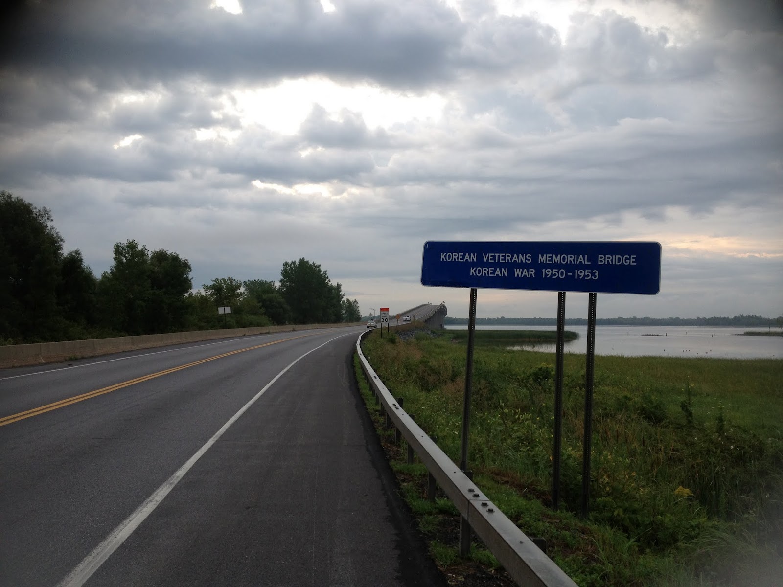
stopped for breakfast. The road crossed several lakes. The sign on
one the bridges read “Korean Veterans Memorial Bridge. Korean War
1950-1953”.


Vermont means mountains and after 5 hours of riding I
was about to face them again. And as I did it in May, before
launching my assault I stopped for lunch. Conveniently, I came upon
some field with benches and prepared my favorite lasagna.


This time, lasagna unpleasantly struck me with its foul smell and I
realized that this is going to be the last time when I eat it. And I
still have 10 packages of it. What a waste! I was sure someone had
tried to eat it before me before throwing it up and repackaging.
Anyway, I finished it and washed it down with orange juice. Orange
juice was indeed my only real and trusted fuel.
Then the climb began. The day was hot,
but thanks to the orange juice I was not dehydrated and I didn't lose
much power. Climbing in Vermont on my heavily laden bike takes
hours. Orange juice is sold everywhere along the road in a very
convenient half-gallon bottles that fit perfectly inside my frame
bag. On a day like this I was swallowing at least 4 litres of it.
Drinking the same amount of water is impossible and would result in
hyponatremia. I was drenched in sweat and regretted that I didn't
take the gloves because my hands became so wet and slippery that I
have to focus so not to lose the grip on handlebar. Finally,
exhausted, I seemed to have reached the highest point of the climb
and spotted a tree that cast a weak shadow. I rushed to it and
dropped on the ground. Gradually, I recovered just enough to continue
my crawl.

Soon, as the day was drawing to a close
I left Vermont mountains behind. I was entering New Hampshire now. I
rode into St Johnsbury and the next road sign indicated that
Lancaster, the last town on my way to campground, was just 25 km
away... And then I realized that it was in miles, not kilometres, so
it is another 40 long kilometres. But it doesn't matter now, it was evening
and the heat was off, and it appeared that I was not going to do any
significant climbing. Relief.


I rode on, on my right-hand side the
giants of New Hampshire appeared with peaks hidden in the low hanging
clouds. Luckily, the road only skirted around the mountains and
didn't go across them, at least, not today. I switched into night
mode - put on my prescription glasses, a cap under the helmet with a
long visor (which protects eyes from air stream and bugs, as the
prescription glasses don't have this round shape, and also cuts off
the beams from oncoming traffic) and attached front light to the tip
of my aerobars. It's quite a capable dynamo light, extremely bright,
especially on descent. So as long as I moved at a decent speed I
could be easily mistaken for a silent motorbike. An eerie sight for
other motorists. And this is even without using my other weapon of
intimidation – a helmet laser beam, which can be pointed directly
into drivers' eyes, causing short-term loss of vision and
disorientation.
It was getting darker, the air was cool
and humid, the moisture was gathering on the handlebar and my hands
and dripping down. I felt thoroughly wet and sticky from the fog and
a day's sweat that never evaporated. But riding at night was
surprisingly comfortable and calm, there were no cars, no heat and no
wind. It was almost like I owned the road, and if other cars did
appear, they were startled to see me and passed cautiously, moving
completely out of my lane. At daytime cars blew past as if I didn't
exist or was no bigger than a cricket crawling along the road.
I was already thinking about making
Dolly Copp campground this night, half-day ahead of schedule, and
then do the climb the same day. According to forecast, on Monday it
should be sunny on the mountain, and cloudy on Tuesday with 50%
chance of rain in the afternoon. But I was in a desperate need of shower (there were no showers at campground), and still was not sure
that it was a good idea to show up too early... In the end I wound up
in a motel 36 km short of campground. And, again, I couldn't get much
sleep that night. That day, also, I lost about 1.5 hours due to the
accident.
This happened in the morning, before I
reached the mountains in Vermont. I think, it was around 10 am and I
was rolling happily along at a good speed when the front wheel hit a
pile of something lying on the narrow shoulder. Looked like a smashed
bottle, I thought, and then I sensed a slight flow of air from the
wheel. Then the wheel started to wobble and in a moment it was
rolling on its rim, thick 2.2 inches tyre folded to one side. The
bike veered to the left into the lane, out of control, and I crashed
with the handlebar and my head hitting the pavement almost at the
same time. I sprawled right in the middle of the road, the car coming
from behind was at a safe distance and stopped. I remained motionless
for another 10 or 20 seconds then slowly picked myself up and moved
off the road to assess damage. Badly scraped left knee and bruised
left shoulder, the one that was already broken twice, last time a
year ago in my unfortunate Massachusetts D2R2 group ride, and a
cracked helmet. Luckily, no broken bones this time and I almost
didn't feel impact on my head. Several cars stopped, people asking
how I was feeling. I felt all right, but my bike needed some repair.
I extracted a big piece of glass from the tyre, replaced the tube and
repaired the punctured one. I only had one spare tube with me, so
every time I punctured I have to repair a bad tube. Not a problem,
the patch glued perfectly and I had no doubts that it will hold.
So that was my second day. I was in
good spirits. Tomorrow I will have a full day of rest in the
campground and then climb Mount Washington on the longest trail –
Great Gulf Trail – 12 km from my tent to the summit at 6,288 ft
(1,917 m). Not really a climb, just a long walk up, the only
difficulty is the steep headwall at the very end leading to the
top. According to the descriptions the trail is very scenic but
avoided by most tourists because of its remoteness and the steep
section at the end. Which makes it more perfect for me.
Day3.
13 August 2012.
36 km. 2 hours 6 minutes.
Mount
Washington, White
Mountains. New Hampshire. Arrival to
Dolly Copp.

I left motel late in the morning,
around 10, but I was in no hurry – it was going to be no more than
2 hours of easy riding today. It was hot already, the road went up
and down some gentle hills and the wind was in my back. The ride was
fast – several long downhill sections, very enjoyable. White
Mountain National Forest was on my right. From my point of view the
mountains were green actually, but they got their name because some
of them, hidden in the central part of the forest, rise above tree
line and are often covered in fog so they appear white as opposed to
smaller green mountains in Vermont.

I nearly missed the turn when I
was flying downhill, the road was empty, I turned around and got off
the main road and rode into the forest. I followed a steep dirt road,
which climbed up and then sharply dropped down as I came to the gate
of Dolly Copp campground.


At the entrance I studied the information
board implying that this place was frequented at nights by hordes of
black bears and was given instructions how to handle my food. I found
my site and set up the tent.


In the valley: Partly sunny. Patchy
morning fog. Highs - Mid 80s F (29 C), Lows - upper 50s F (14 C).
On the summit: In the clear becoming
in and out of the clouds under partly sunny skies w/ a chance
afternoon showers and thunderstorms. Highs - around 60 F (15 C), Wind
- NW shifting W 10-25 mph.
I was planning an early start, while
the weather is still calm on the mountain. Looks like I was in luck.
Before going to bed I took all my bags
with food off the bike and shove them into one corner of the tent
and then put my smelly shoes and socks next to it inside the tent.
Even if bear sniffs out the food it would be protected by this
smell-screen. Outside I have the bike lying close to the tent side to
restrict approach to that corner. That night I decided to try ear
plugs in a hope that if I cut off all the sounds I would be able to
sleep. But absolute lack of sounds felt weird, and, besides, I was
too eager with anticipation of tomorrow's adventure that I almost
needed some background noise to calm me down that I am used to at
home – some familiar creaks of the house and the shakes of the
fridge downstairs and silent blow of air through ventilation. And,
worse, these ear plugs soon expanded inside my ears and were causing
pain, so I removed the one that was between me and the pillow and
slightly pulled the other out. I was lying quietly checking time
every hour waiting for the night to end – tomorrow I am going to
set out with the first light. Suddenly at 4 o'clock I heard and felt
heavy steps approaching my tent and then some snorting just above my
head. Time stopped. I thought about making some noise to scare
off the visitor, but I couldn't move a finger and, I think, I stopped
breathing. At this point I wasn't sure if I was awake or dreaming.
Snorting, muffled by partially inserted ear plug and pillow on the
other side, continued. Then the steps moved away from the tent and I
regained my senses (or awoke from the dream?). Now it was scratching
something on the ground some distance away and, I was certain, had
lost any interest in my tent. At last, all sounds died.
Probably it was a bear making his
nightly rounds of campground. He noticed the newly appeared tent on
his territory and became curious. Next night he came again at the same time but didn't
come close to the tent and was only licking and scraping something on
the ground. Next day about 10 meters away from my tent I found something
that looked like some licked up scraps of food. There are 5 thousand
black bears living in New Hampshire with the largest concentration in
the White Mountain Forest.
Day 4.
14 August 2012.
Climb of Mount Washington.
At 6 in the morning I was out the door.
It was a little chilly but I knew I would be sweating soon. I didn't
eat breakfast, planning to make a stop somewhere along the trail. In
my backpack I had 2 litres of orange juice, litre of water, 1 package
of chili-macaroni and all my rain and warm clothing. It turned out I
would not need it at all, the temperature on the summit was +14 C and
almost no wind – the god of Agiocochook wasn't showing his temper
yet.
 |
| Campground early in the morning. |
The trail was easy to follow with numerous signs at all the
crossings. My invaluable iPhone GPS confirmed that I stayed on right
course. I had another emergency Garmin GPS but I never used and it
was so impractical with its small screen because you can only get a
reasonable amount of details when you enlarge map enough but then all
reference points are gone and you lose your directions.

First 5 km it was an easy forest trail
but soon I was entering Great Gulf Wilderness and the trail became
rocky and narrow.
 I started climbing up and came to the first stream
crossing. At one point there was a suspension bridge across the
stream, but it was always easy to get to the other side of the
shallow stream by stepping on the stones.
I started climbing up and came to the first stream
crossing. At one point there was a suspension bridge across the
stream, but it was always easy to get to the other side of the
shallow stream by stepping on the stones.


As I gained elevation the air became cooler and the rushing sound of the mountain stream quicker and louder. The trail grew steeper and rougher with all the rocks lying around and my movements quickened, soon I was running by hopping from one boulder to another. The going was so easy compared to a heavy slog on a bike the previous days that I felt weightless. Some rocks were wet and covered with moss and sure enough I slipped and added another bloody mark to the scabs on my battered knee. The higher I climbed the more I was surrounded with water. I passed several waterfalls, sometimes the trail was no more than a massive slab of rock rising up at an angle, in other places the trail was completely flooded.


As I gained elevation the air became cooler and the rushing sound of the mountain stream quicker and louder. The trail grew steeper and rougher with all the rocks lying around and my movements quickened, soon I was running by hopping from one boulder to another. The going was so easy compared to a heavy slog on a bike the previous days that I felt weightless. Some rocks were wet and covered with moss and sure enough I slipped and added another bloody mark to the scabs on my battered knee. The higher I climbed the more I was surrounded with water. I passed several waterfalls, sometimes the trail was no more than a massive slab of rock rising up at an angle, in other places the trail was completely flooded.


 |
| Flooded trail. |

 |
| I had to cross this stream several times. |
 |
| This is a trail. |
 |
| Still on the trail. The boulders grew bigger. |
Along the trail there were several
designated places for camping where you can use your stove and even
set up a tent, stepping off the trail was difficult because the
vegetation was dense and there were lot of fallen trees and rubble. I
met another hiker, he was going down the mountain. I didn't
appreciate this at the time, but probably this was a least crowded
trail leading to the mountain. On my way down, on a Tuckerman Ravine
Trail, the traffic was really heavy in both directions. 4 hours into
the hike I came to Spaulding Lake lying at elevation above 1200
meters. It's a tiny and shallow lake no deeper than 1-2 meters. I
paused there for no longer than 5 minutes.
 Here the steep walls of
the Great Gulf were closing in from all sides and my walk was over,
now the serious stuff will begin. I had to climb, using both my legs
and arms, the last 800 vertical meters. Some say that this part is
not difficult and can be walked with occasional help of hands. But I
never climbed a mountain before and to me the safest way up was on
all fours. Anyway, there was no one to see me doing this.
Here the steep walls of
the Great Gulf were closing in from all sides and my walk was over,
now the serious stuff will begin. I had to climb, using both my legs
and arms, the last 800 vertical meters. Some say that this part is
not difficult and can be walked with occasional help of hands. But I
never climbed a mountain before and to me the safest way up was on
all fours. Anyway, there was no one to see me doing this.


 |
| Trail leading up from Spaulding Lake. |


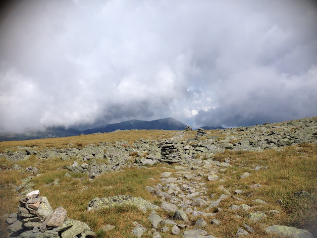
In some places the trail was marked with small cairns and it helped me a little. I checked my position on GPS and it seemed like I was not too much off the trail. Looking down I saw the diminishing Spaulding Lake, resembling a small hole in a green carpet.


I was climbing for a little over an
hour when I spotted another traveler with a dog going up above me.
That encouraged me and I tried to keep him in sight all the time. He
was climbing slowly helping himself with two wooden sticks, his dog
stopping from time to time and looking down at me. Near the top I
caught up to him, he turned around and yelled something indistinct,
his boxer dog ran up to me and licked my hand. He was an old man with long
white beard, and later he told me that this was his third attempt of
this route, the previous two times he could not finish because of the
bad weather.
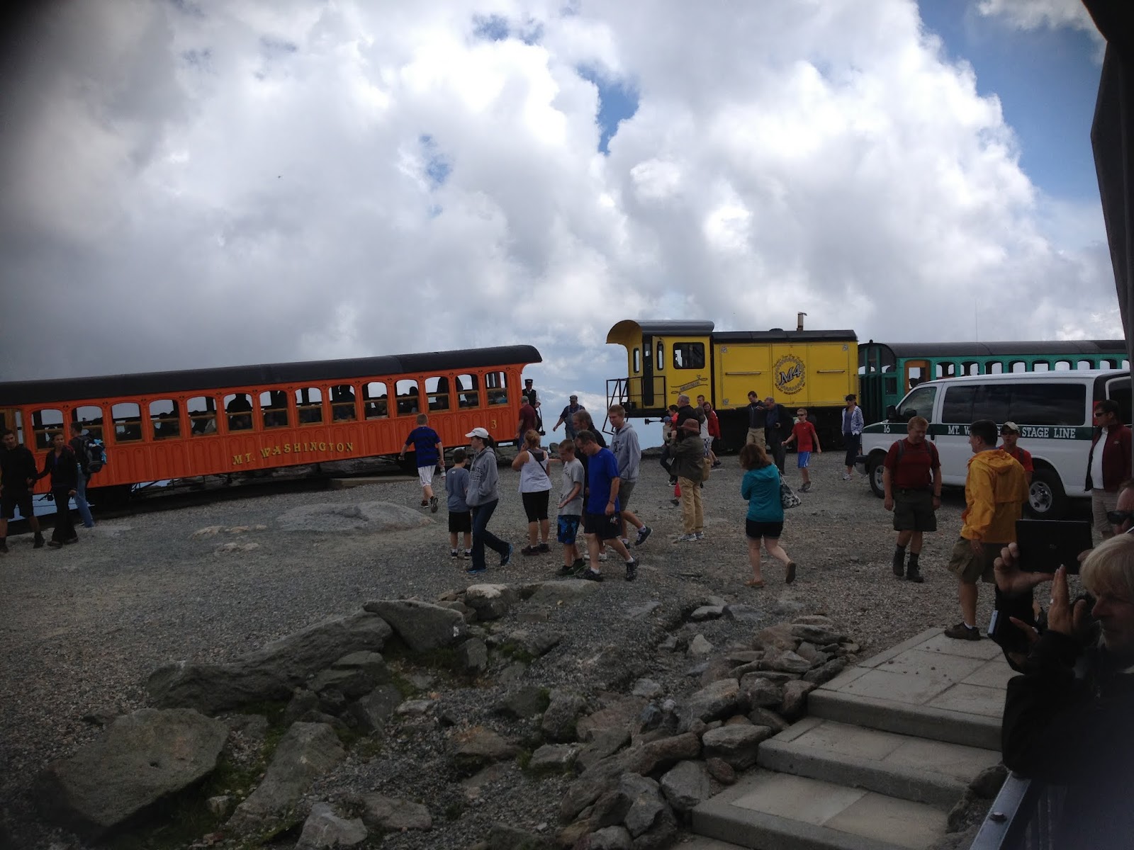
The climb was over. It was 11:40, 5 hours and 40 minutes
since I left my tent. Immediately, I saw many other hikers and
tourists coming from all other directions, it is a crowded place,
every year 250 000 people are visiting the mountain. I walked to the
very top and finished my orange juice. I only needed a little less
than 2 liters to take me up. It was time for lunch now.


 |
| There is another hiker with dog at the top. |
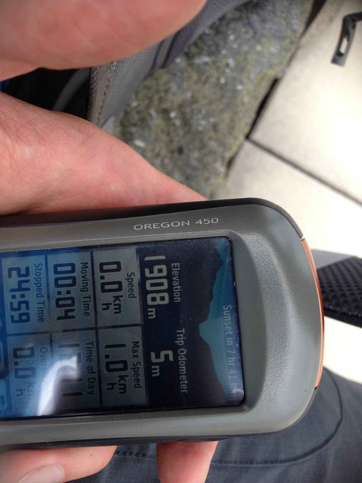 |
| Elevation 1908 meters. |


There are several buildings on the
summit: observatory, souvenir shop and the oldest high-mountain hotel
in the world, now a museum – Tip-Top House – build in 1953, its
walls made from several layers of rocks. Originally it was an
extension to a big three-story hotel that was destroyed by fire in
1908.


Also, there is an office of Mt
Washington State Park with cafeteria,washrooms and gift shop. Inside
under the office sign there are several screens with weather
information and under the heading “The Worst Weather in The World”
a list fatalities on the mountain.
 The list contains the names of 140
people died since 1849. The main cause of deaths are falls: 42, it
includes skiers, rock and ice climbers, and winter hikers. There are
no fatal falls by summer hikers who follow the trails.
The list contains the names of 140
people died since 1849. The main cause of deaths are falls: 42, it
includes skiers, rock and ice climbers, and winter hikers. There are
no fatal falls by summer hikers who follow the trails.
Other causes of death:
 |
| Lunch first. |

Other causes of death:
hypothermia – 30
heart attack – 19
avalanches -12
plane crashes - 10
drowning while stream crossing – 6
falling ice – 5
railroad accident – 8 (all died in a
single accident in 1967 when train brakes failed)
automobile accident -1 (failed brakes
in 1984)
unexplained deaths – 3
Really not much in 150 years, I felt
pretty safe on this mountain. I was in much greater danger while
getting to it, risking my life every minute on the roads, crashing
once and the most scary accident happened on my way back three days
later when the car nearly ran me over on one dark intersection in
Concord.
Somewhere between the buildings there
is a small pile of rocks with a sign atop of it saying that this is
the real Mount Washington summit. There was a long line of climbers in
clean town clothes having just arrived in their cars waiting for
their turn to get to the top. After summiting they carefully, helping each
other, climb down and go straight to the restaurant.


My preferred way was walking down. I
descended by the easy 6 km Tuckerman Ravine Trail. This is basically
a very long and rough staircase. The only disadvantage is that it is
chosen by most of the tourists and going can be very slow. Still the
views were beautiful and the slopes were covered with alpine gardens
and further down there was a pleasant spicy aroma of various pine and
fir trees. I made it down safely, my ankles and knees starting to
give out in the end.


 At the bottom I found a visitor centre with
coin showers and a book store. There was an interesting exposition with
the model of the whole mountain range.
At the bottom I found a visitor centre with
coin showers and a book store. There was an interesting exposition with
the model of the whole mountain range.


 |
| Here you can see the Great Gulf and my
route up. The middle line between two ridges. |
 |
| And here is my route down. The left one that goes from the top into deep green ravine. |
I walked the last 12 km back to my camp along an empty highway. It was the easiest part of my hike. At 8 pm, and 14 hours after I started, I was back. A perfect day.
 |
| Next year I am planning to climb the mountain again, but in a different way. |
Day 5. 15 August 2012.
150 km. 9 hours. Average speed 16.6 km/h. Ascent 1720 m.
Leaving White Mountains. Arrival to Portland, Maine.

It was raining in the morning and I had no desire to leave the tent. Check-out time was 12 pm and I only had to cover 150 km to Portland, so I had plenty of time. The rain stopped finally and I started packing my bags. To my surprise I discovered that my back tire deflated. I could not believe that, I didn't ride yesterday and I was getting flats for no apparent reason. I have never had a puncture in two years since I bought this bike, and now having ridden the first 500 km I already had two flats, with one spare patched tube and another 1000 km to ride. I was sure that yesterday the tire was good, because since my crash two days ago I became paranoid that my tires were leaking air, and I was checking them every hour while I was riding and always before any downhill section. And the tire was definitely firm yesterday and the day before yesterday. And then it dawned on me – bear. Son of a bitch! Hungry beast. I was instantly relieved, at least now there was an explanation and my tires and tubes, after all, were not so bad. So I looked carefully for teeth marks on the tire and found none. I was puzzled. I removed the tube and it appeared intact. Actually, it was not completely deflated, just soft. I checked the tire - and found no sharp objects in it, then I inflated the tube a little and, holding it very close to my face, rotated it slowly and finally detected a microscopic hole, not visible to the eye, but releasing a thin whiff of air that I sensed against my skin. That slowed my departure for another hour, and when I was leaving the campground at 12 pm, the skies were blue again. But not for a long time. First 10 km I was flying down. The road was covered in wet patches with dark clouds swirling overhead, but every time it started raining I managed to get away just by riding faster. I didn't want to lose my speed so I didn't stop to check my tires and was bracing myself for a sudden fall caused by failed tire. And I had a reason for this. Yesterday, while I was walking back on this highway I was paying close attention to what was lying on the narrow strip of the shoulder. And I saw shards of broken glass, pieces of wire polished by time and car tires, dangerously sharp and thin, and other junk. The road itself was clean from this rubbish. So I moved off the shoulder and was riding near the right edge of the lane. Anyway, the traffic was light and cars can always go around me, and for me it was much safer to ride closer to the middle of the road.
When I was passing and leaving Mount Washington behind it was covered in clouds, as were all the mountains around me. I don't think that this mountain has The Worst Weather in the World, it's more of a marketing slogan to attract more visitors than a true observation. It is a deceptively small mountain but it still belongs to this violent breed of stone-faced snow-covered monsters that were killing people all the time by throwing them down or freezing them to death or eating them alive. Probably the location and climate patterns make the weather at this elevation as unpredictable as in the other regions of much higher mountains. But down here it was quiet and the world was more forgiving.
Soon I was leaving the park and heading south-east towards Maine and my true destination – Atlantic. All the rains were left behind and it was hot and sunny again. I was riding through mountain resorts zone now – the road was packed with cars moving slowly bumper to bumper, and I felt my superiority as I was gliding past them, everywhere there were motels and stores with facades decorated in some bright maritime theme. I met several groups of cyclists on road bikes enjoying themselves and happy with the weather. Suddenly, out of the corner of my eye I saw the word “Cyclery”. I needed spare tubes. Quickly I turned around and found a bike shop. There I bought two new tubes for $18. Another stroke of luck.
Soon I crossed state line and rode into Maine. Here I stopped for lunch in the picnic area with comfortable tables. Chili-macaroni with beef was a welcome snack.


30 minutes later I continued my journey and turned onto boring and flat road that seemed to have no end. I was riding into the constant south-easterly wind, the only consolation was that it was blowing from the ocean, or that was what I wanted to believe. Everything along the road reminded me of places around Moscow as I remember them 25 years ago not damaged yet by growing villas and dachas. Only road signs had an unusually sounding names - Standish, Cardish. I became tired with 20 km to go and turned from the road into the wood for a short rest. At 7 pm I reached outskirts of Portland.

It was early evening and I decided to ride through the city for a quick recon of downtown and then go across the bridge and to the south part of town from which the thick vein of highway was running and promised abundance of motels. So after another hour and 20 km of riding I stopped near the first motel that I saw - Maine Motel – I paid for one night and roll my bike into the room on the first ground floor. Later I decided to stay here for another night and have a whole day tomorrow to explore the town.

Day 6. 16 August 2012.
Portland, Maine.
Portland, Maine.
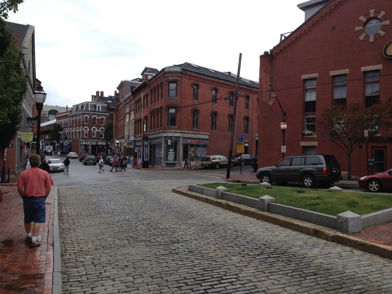
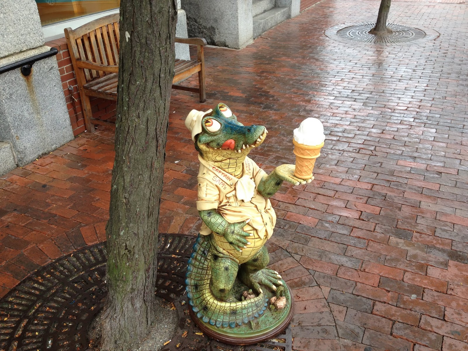
Next day after the breakfast consisting of two Dunkin Donuts sandwiches with eggs and bacon, fresh yogurts and tea I headed outside. My first stop was department store in the nearest mall where I bought a t-shirt, I didn't want to look like I was playing a boy scout in my cycling jersey. Then in the supermarket I bought 2 green apples, drinks and a package of sliced watermelon to keep me comfortable during the day's promenade. It was a warm and cloudy morning with the afternoon rain in the forecast. I circled the town from the south passing Portland International Jetport and then walking through quiet cemetery. In about 3 hours I reached the city's central park and after a short walk from there I was on the old cobbled and brick streets of downtown. The town had a distinctive laid-back and relaxed feeling, nobody was hurrying anywhere, clearly the only business that existed there was that of tourists and restaurants and fishing. I crossed the central part, stopping in numerous souvenir shops and checked out a bakery. It started raining when I reached the wharf and I ventured a little further into the east end - the location of the Eastern Promenade, Fort Allen and Maine Railroad Museum. Unfortunately my excursion ended there and I had to turn back and look for a cover to wait out the rain. I ran into the Dry Dock tavern and ordered a dinner. It was a roasted haddock with fries and coleslaw salad with a bottle of local beer – the best meal ever I have eaten in North America so far. I was sitting by the window and looking outside and the rain didn't show any signs of relenting – sadly, the day was over, I had to return to my motel. Tomorrow I am going to start my trek back – 4 days and 850 km of bike adventures on the road home – not bad at all.


195 km. 12 hours 29 minutes. Average speed 15.6 km/h. Ascent 2678 m.

At 11 am I was on the road again – I am a late starter – but then I was in no hurry and this wasn't a race. I could enjoy my ride and I intended to do so. Highway 50 south was busy and it was a hot day, all the traces of rain were gone. I felt fresh and motivated and tried to ignore the heavy traffic on the road – I just needed to reach one more place – the ocean. Nothing else mattered. After that I will disappear into the vast network of country roads, and have a greater choice of routes to take – so that I don't need to share it with cars. About 50 km out of Portland I rode into the beaches zone. I turned off the highway and followed a narrow road for another 3 km and straight to the resort strip. Here I finally felt the stiff breeze blowing from the ocean and its presence became unmistakable. Portand, although an ocean port, is shielded from the ocean by a string of islands around its still-water harbor. I wasn't alone in my pilgrimage, the road was packed with cars coming here for weekend – it was Friday afternoon. The rocky shore was lined with houses and other buildings, so there was no direct access to the water and I had to pedal another 5 km and came to the enormous parking lot where all the cars were streaming along with all local beachgoers travelling on foot or bikes. I circled around. I didn't have any desire to plunge into this sea of people. While I was riding along I noticed that there were several stretches of open shoreline, rocky and not suitable for a public beach, but still approachable. I came here not to swim, I just wanted to sit and listen to the waves and look. So I turned back and found a nice secluded place on the rocks, where I can be alone and take in the views.


Time for lunch. I had salami, two sorts of cheese and flat breads with orange juice. Delicious food. I stocked up with several packages of these for my trip back and it lasted for almost three days. As I sat there, I realized clearly for the first time, that this moment was why I had taken this trip. This was the end of my journey, there was nowhere else to go, I reached the end of the earth. Very close end. Disappointing. My every ride had been disappointing in this sense – there came a point when I have to turn back, effectively cancelling all my efforts of getting there. I hoped that if I would go on a long ride like this I wouldn't need to turn back. I was wrong. Regrettably and inevitably I had to return to reality and keep moving. The day passed uneventfully. Just a long, slow and boring day of riding and sweating. By the evening, having ridden just 150 km, I reached Concord, New Hampshire. I was awaken from my dazed state by sudden darkening of the skies, not the usual night calm darkness, but disturbingly heavy and deep violet blackness. Ten minutes later the lightnings followed, getting closer and closer, the sky started booming with explosions and sent down torrents of water. At that time I was already riding through the town so I raced to the cover of the nearest gas station. Floods of water were swirling around, booming and cracking sounds in the air. Somewhere in the distance the sirens began to wail. I was thinking what I was going to do next – I still needed to cover at least 50 km more, but I didn't want to end my day somewhere up in the mountains under the rain (for some reason I thought that there were mountains in front of me, but actually they were only in my imagination). So, timidly, I started thinking about finding a motel in this town. In 20 minutes the storm passed and I continued riding. I think I lost almost an hour, maybe more, in search of a motel. Found nothing, but instead nearly got hit by a car on one intersection that I managed to cross twice in my aimless dashes back and forth. First time I hit a deep pothole with the front wheel causing the bike to emit a loud clank. Then some time later I was riding through the same intersection but in an opposite direction and a car, approaching from the other side, decided to turn left right into me. I stopped sharply and waited, he noticed me when there was less than a meter between us. Had I not done this he would certainly have slammed into me. I know, I had already tried this, if you ignore the car they only notice you when they hit you. To attract their attention you have to stop.
For the next hour I continued blundering through the dark streets until I decided to get back on my course. The rain stopped but roads remained wet, the air was still and crickets blasted out their cacophony at the top of their lungs. This must be a good sign, insects know when the danger has passed. I felt at peace again. Night is a wonderful time.
Soon I found myself on a dead straight highway, I was trying to find a place for the tent, but this was some major highway with deep gutters and steep slopes above on both sides of the road, wide shoulder too. I could ride for hours and this road will never end, and it was already 12 or 1 am. So on the next intersection I turned away and decided to stop atop of a high embankment along one side road just off the highway. Quiet place, nobody is going to bother me. It was more of a wakeful rest than a sleep. In the morning it was raining again, I got up at 6:20 am, put on my waterproof jacket and shorts, packed the wet tent and continued along the same highway.
Day 8. 18 August 2012.
270 km. 19 hours 30 minutes. Average speed 13.7 km/h. Ascent 5000 m.

 |
| Night section. |
Again I was on this dreadful highway, wide and straight without trees and a lot of cars. The sight of wet pitiful cyclist on a weird looking bike with bags apparently was causing some amusement from the passing cars as I received several hoots. I didn't care, but I hated those cars and the people riding in them because from the comfort and warmth of their seats they looked at me as if I was an unfortunate road victim. And I felt this way, but not because of a wet weather, but only because of the noise from the cars and their indecent speed. Those kinds of emotions always rise in me after any prolonged riding in a heavy traffic.
Now I recognized this road – it was big “green” Route 9 leading to Bennington in Vermont (where it is known as the Molly Stark Byway, ironically, it is described as "a great way to experience the full character of southern Vermont") - the shortest and the most straight way to my day's destination, but also the most painful and even dangerous. I didn't know that when I first travelled this road 3 months ago in May. There is a section east of Bennington in Vermont Green Moutains – the road there is very narrow, two lanes, almost no shoulder, and it's going up in a twisted course for 15 km to the top. It even has central double rumble strips. The main danger is a constant movement of heavy and very long trailer-trucks going in both directions. If such two trucks happen to meet, there would be no space left on the road, not even for a bike. Then comes the descent and competition for the road increases because I cannot ride just 10 cm from the edge at 60 km/h. The trucks go much faster and they cannot stop. This road should be avoided. Another unpleasant memory was that I had become so exhausted that I could not push pedals anymore even in the smallest gear of my mountain bike – 28x36. Then I had to walk with my bike for about 20 minutes until the road leveled out a little. For hours I was walking and riding and walking again in a thick fog and constant rain. I wanted badly just to lie down, maybe pitch a tent to hide from the rain. I realized I needed to restore my energy levels so when I saw a neatly trimmed lawn by the side of the road I quickly stopped there, started a stove and prepared a hot meal from freeze-dried chili-macaroni with beef. Turned out it was a cemetery, and just when I had finished my food a truck drove up and two fellows jumped out and began unloading their digging instruments.Time to go. Refilled, the legs felt better, all the fatigue was gone.
But now my plans were different. After one more hour of riding I turned onto quiet forest road with almost no traffic. Immediately I felt a sudden surge of strength and energy. It was around 8 am – time for breakfast. I was riding through a small village and stopped near one convenience store, it was closed, but there was a veranda with a table and chairs. I couldn't wish anything more comfortable. Salami, cheese, flatbreads and orange juice again. A memorable breakfast.


In fact, I consider this my best day on a bike, I discovered new roads without cars, some of them dirt and for the most part I was climbing into the mountains of Vermont surrounded by trees from all the sides. Green mountains, blue sky, perfect weather. The air was cool and infused with freshness of green leaves, probably because of elevation and a microclimate created by the surrounding mountains. A very scarcely populated area with no towns and only occasional white houses hiding in the trees. Soon I came upon a small meadow with a little pond in the middle. There was a picnic table so I stopped for a short rest.

When I reached the valley the contrast in temperature was noticeable. It was hot and humid. The roads became busy again. Initially, I was planning to ride to Saratoga Springs, New York, and stop for a night in a motel. Probably it is the largest town on my whole way. I arrived in Saratoga at 8 pm, in the darkness, having covered 220 km. But as soon as I was on its streets I intensely disliked it. The whole town was holding a big celebration – people pouring into the streets, beating of some Saracen sounding drums, fireworks. Cars everywhere. I could not understand this – was it some local holiday, or the town was populated by especially merry and noisy people. I knew it was not good for me, because nobody is going to notice me, my illumination no longer impressed anyone, I lost the safety cover of the darkness and sooner or later some car will run me over. My only salvation – is to get out of here and quickly. I turned away from the main street and soon was on the edge of the town. I stopped in at a Dunkin Donuts shop at a gas station and bought two sandwiches and two big cups of tea. I had already completed my daily mileage, so now I could take it easy – if I felt like stopping to rest or drink a cup of tea I could do it. I was enjoying the pleasures of night riding.
10 km later I found myself in a desolate rural country somewhere in New York state. There was not a single motel anywhere in sight. Sleeping in a tent was out of the question, the unholy racket of thousands of night creatures was overwhelming. It was a country of farms, lowlands, manure and cows. Being in a wet tent on a low ground on such a night was no different from self-imposed imprisonment, I better keep riding, and, besides, I didn't feel tired. So my decision was to ride slowly, try to relax in the saddle and thereby get some rest while riding. Good. I must adopt it as my new relaxation technique. Tomorrow I will be even stronger. It was almost midnight. An hour later I stopped at a next gas station and drank a cup of coffee with cinnamon bun. The store was empty and a lonely shop girl was mopping the floor. While I was sitting at the table sipping my coffee two barbarian types with flattop haircuts in alkogolichka undershirts and pulled-down shorts entered the store, both square, one shorter, with broad tattoo covered shoulders, that gradually morphed directly into head. Must be local farmers. Outside, sheriff's police car pulled up. It was 0:30 am.
At 2 am I pulled into Johnstown, big town. I found a shopping plaza with all-night Dunkin Donuts. I locked my bike outside and bought 3 bottles of milk (it was a whole milk and next morning my stomach would revolt against it, although I could not finish a third bottle), and a donut.
